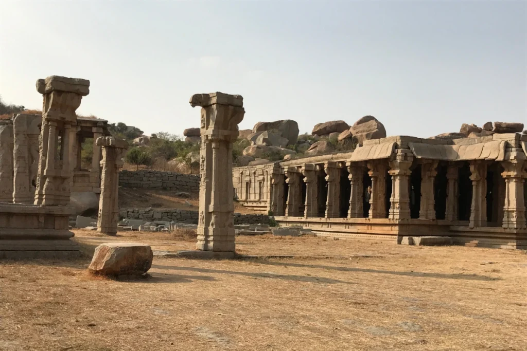
This Hampi landscape guide covers four days inside one of the oldest and most unusual geological formations in India: the granite boulder country of the Deccan Plateau, where the Tungabhadra River cuts through 2.5-billion-year-old rock and a UNESCO World Heritage City was built because the boulders were impossible to attack.
We left Bengaluru at midnight. The plan was to avoid the heat by arriving before it. We arrived at 8 AM and the temperature was already climbing.
This is how Hampi works. The sun rises on a landscape of rounded granite boulders the colour of warm honey, and within two hours the rocks are radiating the heat they absorbed the day before back into the air at face level. By 11 AM, touching a boulder means burning your palm. By 2 PM, be somewhere with shade, or inside the river.
We were at Hampi from September 28 to October 2, 2023: four nights at Gravity Café Stay Chill Hampi on Hippie Island, INR 5,262 / 60 USD for the stay. The Hippie Island side of the Tungabhadra is quieter, cheaper, and 30 to 45 minutes from the temple side. We chose it for the price and discovered that the riverside landscape it put us inside was the better choice for understanding what Hampi actually is.
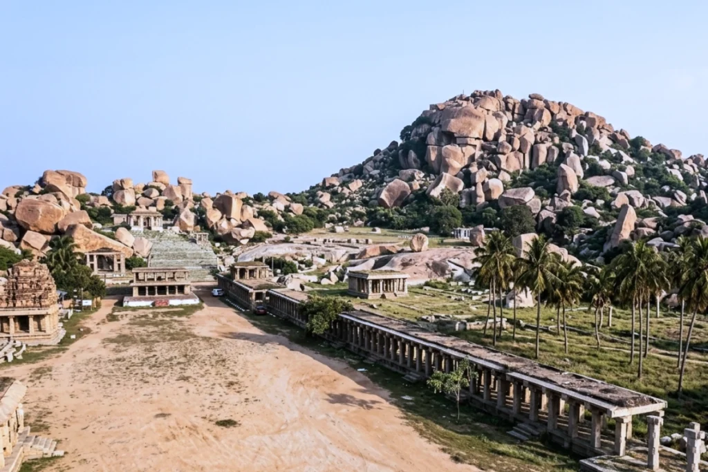
Hampi is famous as an archaeological site: the capital of the Vijayanagara Empire, the wealthiest city in 14th and 15th-century India, a UNESCO World Heritage Site with over 1,600 surviving monuments. The ruins are the reason most people visit. The boulders are the reason the ruins are there.
“We arrived at Hampi in 38°C heat at 8 in the morning, after driving through the night from Bengaluru. The boulders were already hot when we reached them. By afternoon they were too hot to touch. The heat is not incidental to Hampi. It is part of the landscape’s character. The granite holds it, radiates it, and returns it to you.“
- What the Boulders Are
- The Tungabhadra: River That Made the Landscape Possible
- The Heat as a Landscape Element
- Kishkindha: The Sacred Geography of the Boulders
- Matanga Hill: The Highest Point and the Cloud That Replaced the Sunset
- The Hippie Island Side: Where the Geology Is Most Present
- The Tungabhadra Riverside Walk
- What It Costs
- Before You Go
- Frequently Asked Questions
What the Boulders Are
The granite formations at Hampi belong to the Dharwar Craton: one of the oldest stable blocks of the Earth’s continental crust, formed approximately 2.5 billion years ago during the late Archaean eon. The Deccan Plateau, on which Hampi sits, is one of the places where this ancient basement rock is exposed at the surface, stripped of the younger sedimentary layers that cover it elsewhere.
The granite was originally molten rock that cooled slowly deep within the Earth’s crust, crystallising over millions of years into the coarse-grained stone visible on every surface at Hampi. The large crystals… feldspar, quartz, mica… are visible with the naked eye in any freshly broken surface. The rock has been at the surface for hundreds of millions of years, long enough to have been shaped into its current forms by the specific weathering process that the Hampi landscape makes so legible.
Spheroidal Weathering: Why the Boulders Are Round
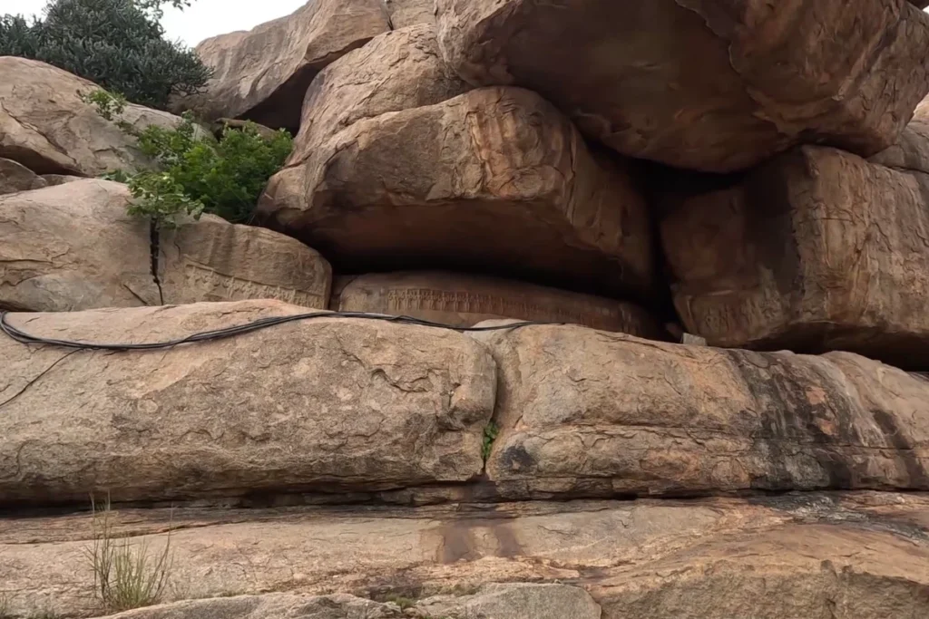
The boulders at Hampi are round because of a process called spheroidal weathering. When water percolates through the joints and fractures in granite, it reacts chemically with the feldspar minerals in the rock, converting them to clay. This chemical decay works inward from the corners and edges of a rectangular granite block faster than from its flat faces, because the corners have more surface area exposed to the water per unit volume.
The result: over millions of years, the sharp corners of the original angular block are progressively rounded. The rock sheds its corners layer by layer, like peeling an onion, leaving the rounded boulder forms that characterise the Hampi landscape. The outer surfaces are smooth and slightly flaky… these are the exfoliation sheets, successive thin layers of weathered rock separating from the mass below.
Looking at a Hampi boulder up close, the layers of exfoliation are visible as concentric curved surfaces peeling away from the core. The rock is working outward from the inside. The process that produced these shapes has been running for millions of years and is still running. The boulders are not finished.
“Stripped of soft earth over deep time, the Dharwar granite does not collapse… it peels. Layer by paper-thin layer, millions of monsoon rains soften the hard edges, leaving behind giant stone spheres suspended in a delicate, millennia-old equilibrium.”
The Tungabhadra: River That Made the Landscape Possible
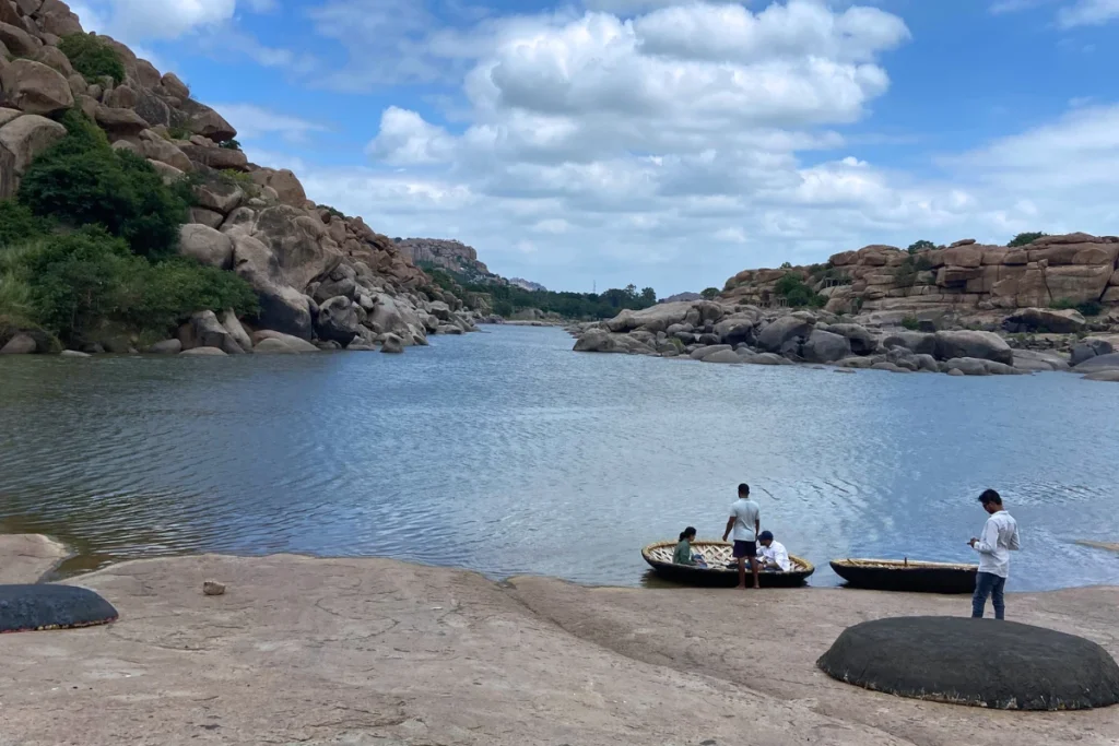
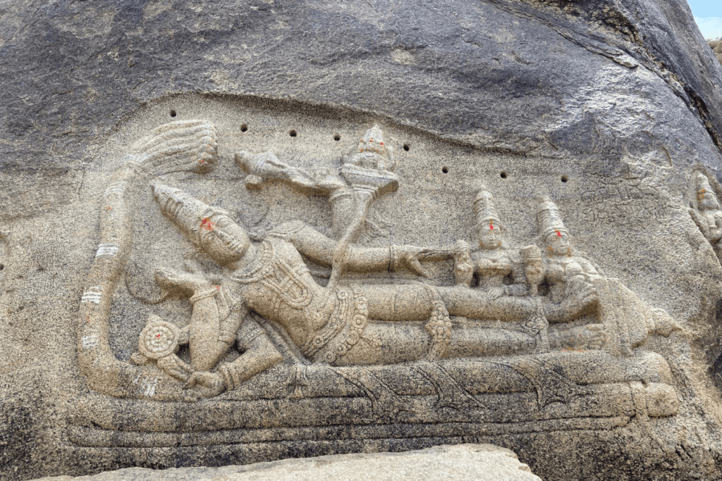
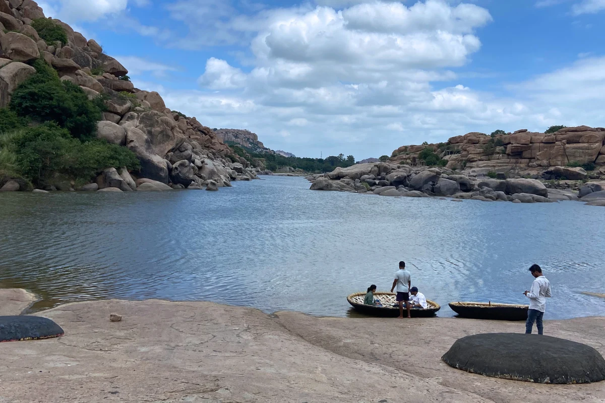
The Tungabhadra River originates in the Western Ghats at Chikmagalur… the same coffee country we drove through on the Hassan-Sakleshpura route. It flows northeast through Karnataka, cutting through the Deccan Plateau granite on its way to join the Krishna River. At Hampi, it cuts through the boulder landscape in a series of rapids and gorges that the Vijayanagara Empire used as a natural defensive boundary on the northern edge of their capital.
The gorge at Hampi is not dramatic in the way that a Himalayan gorge is dramatic. It is wide, relatively shallow, and spread across a rocky riverbed where the water moves between and around the boulders in channels that change seasonally. In September, at the end of the monsoon, the river is full: brown with the silt from the upstream catchment, moving with purpose. By March, the same channels have narrowed and the boulder-studded sandbars appear.
The Sunrise from the Road
On our second morning in Hampi, we left the hotel before dawn and drove to the Tungabhadra River to watch the sunrise. Not from a designated viewpoint. From the road where it crosses the river’s edge, where the water and the boulders and the eastern sky were all simultaneously visible.
The sunrise on the Tungabhadra at Hampi is the specific experience that the landscape is best suited to provide at that hour. The light arrives first on the highest boulders, turning them orange while the water below is still dark. Then the water surface catches the light. Then the boulder shadows lengthen across the sand. The sequence takes about fifteen minutes and is completely unhurried, because the landscape has been producing this same sequence every morning for millions of years and has developed no urgency about it.
The Coracle Crossing
The traditional boat for crossing the Tungabhadra at Hampi is the coracle: a small, perfectly circular boat made of woven bamboo and coated with hide or tar, propelled by a single paddler with a flat paddle. The coracle is one of the oldest boat designs in human history, appearing in multiple cultures across the world independently because the circular form is maximally stable for a minimal structure.
The Hippie Island side of the Tungabhadra is accessible from the main Hampi side only by coracle. This is not a tourist experience. The coracle is the practical transport between the two sides of the river, used by local residents, farmers, and travelers. The paddler crosses the gorge in broad arcs, reading the current and adjusting the angle of the boat to compensate for the water’s pull. The crossing takes three to five minutes. The fee is nominal. The experience of sitting in a circular boat on the Tungabhadra, with the Hampi boulders on both banks, is one of those travel moments that photographs document but do not replicate.
The Heat as a Landscape Element
The heat at Hampi in September is not weather. It is geology.
The granite of the Dharwar Craton has a high specific heat capacity: it absorbs a large amount of thermal energy before its temperature rises, and it releases that stored energy slowly. During the day, the boulders absorb solar radiation. At night, they release it. By the time you arrive at 8 AM, the boulders are already warm from the previous afternoon’s absorption. By 11 AM, they are too hot to lean against. By 2 PM, the air between the boulders is significantly warmer than the ambient temperature, because the rocks are radiating from multiple directions simultaneously.
We drank coconut water at Virupaksha Temple on Day 2. The coconut water near the temple is cold, abundant, and of significant help for what the landscape is doing to your body. We ate bhel at the Vittala Temple complex because food options in the monument area are limited, and the bhel was available and cooling in the specific way that a snack made of puffed rice and tamarind is cooling in 38°C heat.
When it rained on the afternoon of Day 2, the temperature dropped by several degrees in a few minutes and the status between the boulders and the air completely changed. The hot rocks met cold rain and the air filled with the smell of warm granite meeting water: the specific smell of rain on ancient rock. We stood in it and understood, viscerally, why the Tungabhadra basin has been inhabited continuously for thousands of years. The rain, when it comes, changes the entire character of a landscape that the rest of the year belongs to the heat.
“By noon, the granite ceases to be stone and becomes an oven. The air above the rocks shimmers with stored sunlight, reminding every traveller that in Hampi, the landscape does not merely host the weather… it generates it.”
Kishkindha: The Sacred Geography of the Boulders
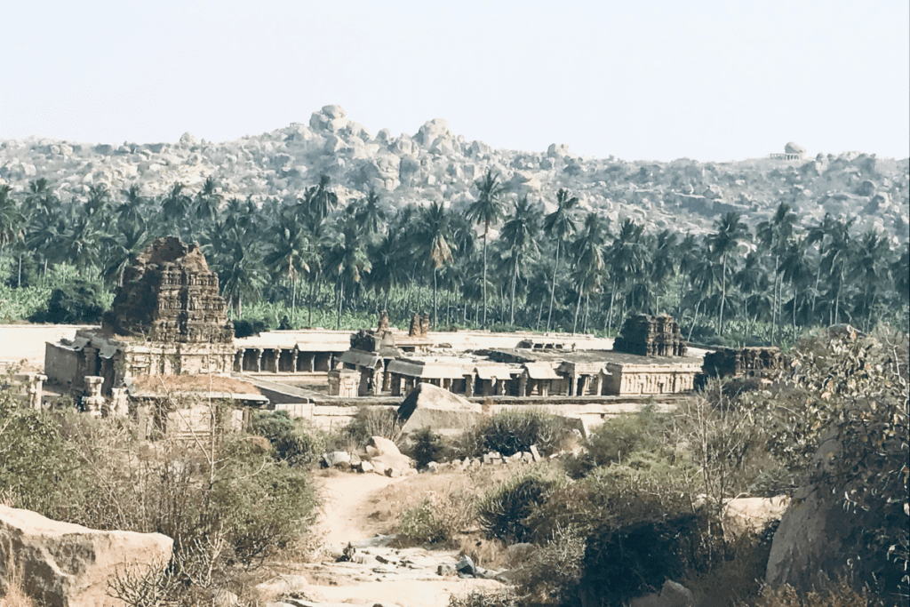
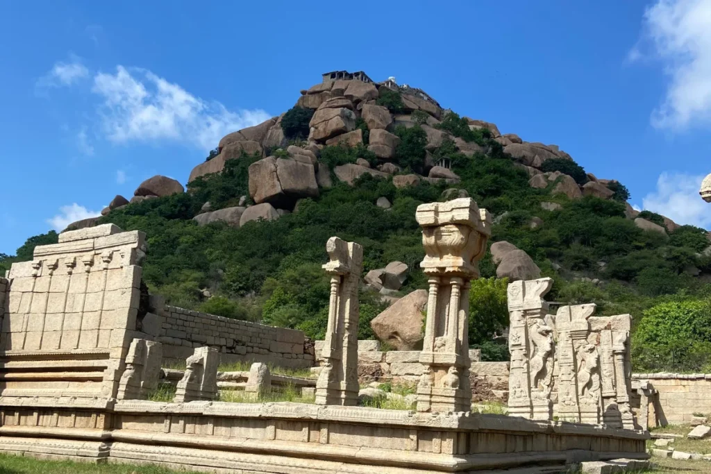
The Hampi boulder landscape is identified in the Ramayana as Kishkindha: the kingdom of the Vanaras (the monkey people led by Sugriva), where Rama came in search of Sita after her abduction by Ravana. Hanuman was born on a hill in this landscape… Anjanadri Hill, identifiable near Hampi… and it was from this boulder country that Hanuman set out for Lanka.
The mythological identification of Hampi as Kishkindha is not merely symbolic or literary. It is topographically specific. The Tungabhadra River corresponds to the Pampa River mentioned in the Ramayana as the site where Rama met Sabari and where he mourned Sita’s absence. The boulder landscape matches the Kishkindha described in the text: a place of mountains and rocks, not forest, where the Vanaras moved between the formations.
Standing inside the boulder landscape and reading it as Kishkindha produces a specific experience that the archaeological reading of the same landscape does not. The Vijayanagara ruins are 600 years old. The Ramayana’s Kishkindha is several thousand years old as a narrative. The granite boulders that both traditions occupy are 2.5 billion years old. The three timescales coexist in the same place, and the oldest layer… the geological… is the one that made all the others possible.
Local tradition elevates this geological ancientness into sacred myth: local lore speaks of these granite mounds as remnants of divine energy stored during creation, or as stones gathered by Hanuman’s army for the bridge to Lanka. This reading of the boulders as spiritually charged material—not merely as inert mineral, but as physical containers of sacred history… is essential to understanding why successive empires selected this rugged basin as their sanctuary.
Matanga Hill: The Highest Point and the Cloud That Replaced the Sunset
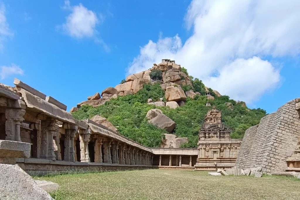
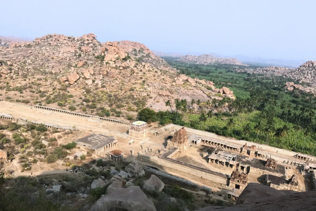
Matanga Hill is the highest point in the Hampi landscape: a substantial boulder-pile rising above the surrounding flat terrain to give a 360-degree view over the entire Vijayanagara complex, the Tungabhadra, and the boulder country extending in every direction.
The climb to the top of Matanga Hill is described in our trip notes as ‘scary’ and ‘not recommended for children and old aged people and also whoever are not fit.’ This is an accurate description. The path is steep, the rock surfaces are uneven, and the final section requires placing hands and feet on the boulder face. The climb at the end of a full day of walking the Hampi monument circuit, in fading light, after 38°C heat, is a specific kind of difficult.
We climbed it anyway. The summit view over the Hampi landscape, even in the dusk before the sunset that we were aiming for, is the view that explains the site. From the top, the relationship between the boulders and the temples becomes visible as a system: the temples are in the valleys and on the banks, the boulders are the walls, the Tungabhadra is the moat. The Vijayanagara Empire built their capital inside a natural fortress. From Matanga Hill, you see the fortress.
The sunset was behind cloud. The sky darkened and the cloud sat where the orange should have been and the sun set somewhere inside it without showing itself. The vlog description from that evening: ‘Although the clouds hid the sunset, the experience, the views, and the emotions were priceless.’ This is not consolation. It is a statement about what the landscape provides regardless of the light. The Hampi boulder country at dusk, even in cloud, is its own experience.
“From the windswept summit of Matanga, the grandeur of Vijayanagara resolves not as ruins scattered in a field, but as an ancient stone city sculpted into the natural folds of an unyielding granite fortress.”
The Hippie Island Side: Where the Geology Is Most Present
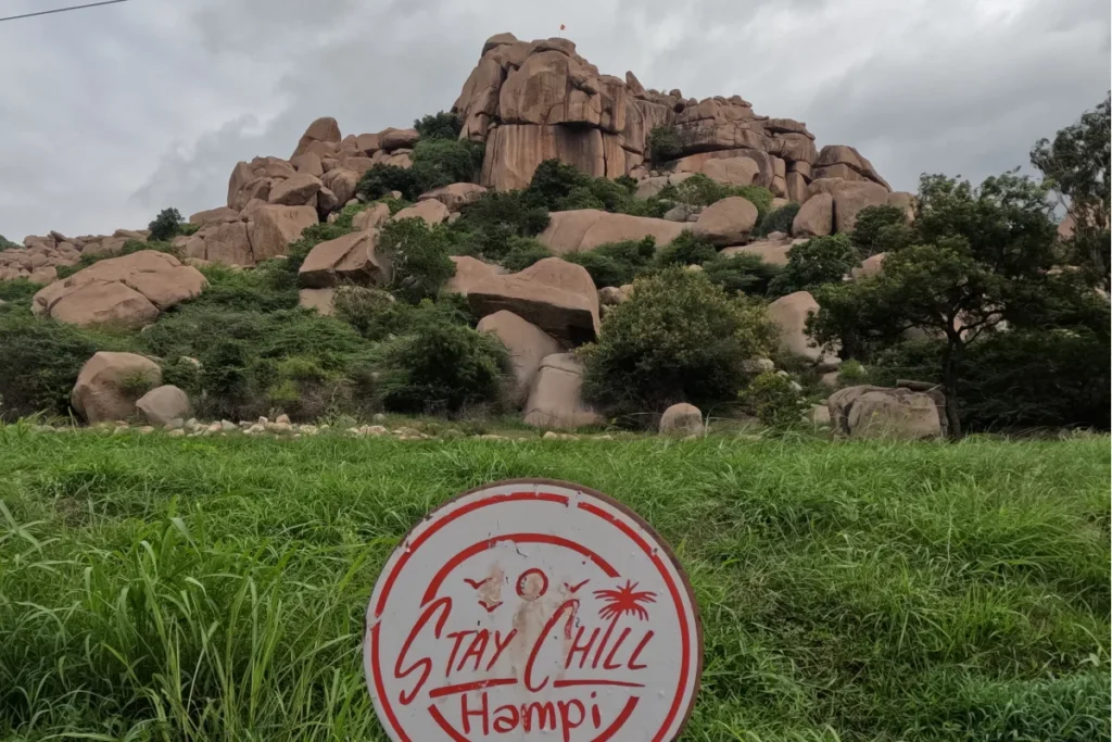
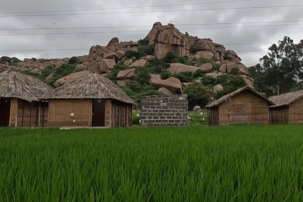
The northern side of the Tungabhadra… traditionally called Hippie Island (now centred around Sanapur and Anegundi following the relocation from Virupapur Gaddi)… is where the boulder landscape is most immediately present and least mediated by archaeological infrastructure.
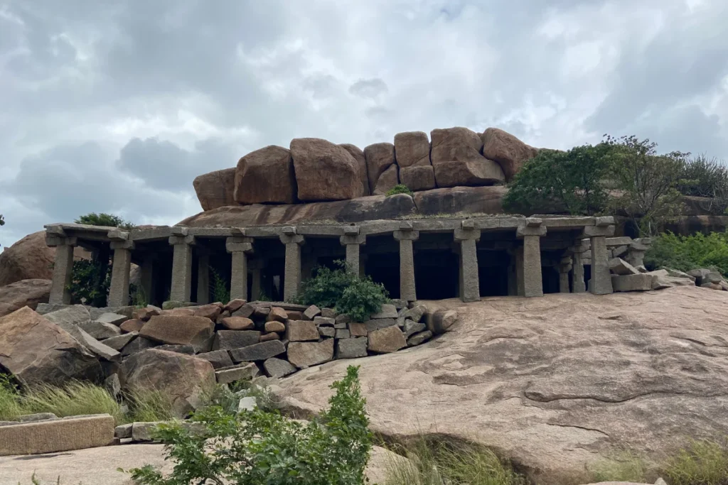
The temples and ruins are on the main Hampi side, between the river and the plateau. The Hippie Island side has a few ancient structures but is primarily paddy fields, banana plantations, and guesthouses scattered between and inside the boulder formations. The boulders here are the accommodation, the backdrop, and the neighbourhood simultaneously.
Gravity Café Stay Chill Hampi, where we stayed, sits inside this landscape. The cottages are simple. The surrounding boulders are not. Sitting outside in the evening when the temperature has dropped, with the granite formations visible on every side and the Tungabhadra audible nearby, produces the specific quality of presence in a geological landscape that the monument side does not provide: the sense that the boulders are not behind the experience but inside it.
Nothing to do after dark on Hippie Island. No restaurants open late. No nightlife. The boulders in the dark and the sound of the river and the specific silence of a place that closes early because it has been closing early for millions of years. This is not a complaint. It is the right end to a day spent inside a landscape that does not require entertainment to sustain attention.
The Tungabhadra Riverside Walk
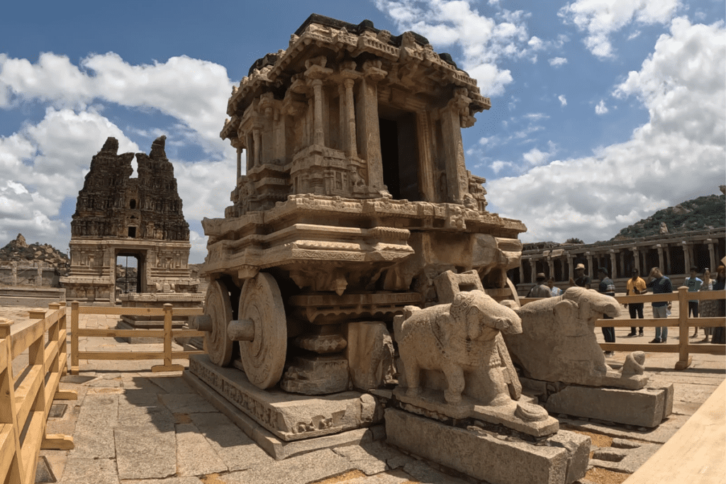
The riverside walk from behind Virupaksha Temple to Vittala Temple is the walk that most Hampi visitors take in the wrong direction or in the wrong heat. We walked it on Day 2, departing from Virupaksha in the morning.
The path runs along the southern bank of the Tungabhadra, winding between the river’s edge on your left and the towering boulder formations rising to your right. The path crosses boulder fields, climbs briefly between formations, and descends to sandy riverbanks. Along the way: the Kodanda Rama Temple ruins with Shivalingas carved directly into the exposed bedrock on the river floor (visible in certain water levels), the scattered ruins of riverside temples whose walls incorporate the boulders as construction material, and the specific sound environment of a boulder landscape… wind through rock gaps, water over stone, nothing else.
The walk took approximately 45 minutes at a pace we would describe as heat-appropriate: not leisurely, but certainly not urgent. The Vittala Temple is the destination. The walk is the approach. Both are worth the time.
What It Costs
| Item | Cost (September 2023) |
| Gravity Café Stay Chill Hampi, 4 nights (two people) | INR 5,262 / 60 USD |
| Coracle crossing, Hippie Island to main Hampi side | INR 30 to 50 per person / 0.35 to 0.60 USD |
| Virupaksha Temple entry | Free (Optional INR 50 / 0.60 USD for photography) |
| Vittala Temple complex entry | INR 40 / 0.50 USD (Indians) / INR 600 / 7 USD (Foreigners) |
| Hampi Ruins general site (many monuments free) | Individual entries vary; most free |
| Fuel, Bengaluru to Hampi return (350 km each way) | Estimate INR 2,500 to 3,500 / 30 to 40 USD |
Hampi is one of the least expensive UNESCO World Heritage sites in the world to visit. The accommodation cost on Hippie Island is significantly lower than on the main temple side. The Vittala Temple is the highest entry fee in the complex. Most monuments charge nominal fees or are free. The primary cost is the fuel for the Bengaluru drive.
Before You Go
- Visit in October to February. September is the end of monsoon: the river is full and the landscape is vivid green, but the heat is extreme and some monument interiors are damp. October onwards, the heat eases and the post-monsoon green persists. Summer (March to June) is brutal.
- Stay on the Hippie Island side. The accommodations are significantly cheaper than the main temple side, and the boulder landscape is more immediately present. The 30 to 45-minute drive to the temple side is the tradeoff.
- The coracle crossing is a must at least once. It is the practical transport between the two sides and the specific experience of the traditional Tungabhadra river crossing. Pay the nominal fee and take the boat rather than driving the long way around.
- Do not touch boulders between 11 AM and 3 PM. Not a metaphor. The granite stores heat and the surface temperature can cause burns. Carry water constantly. The coconut water near Virupaksha Temple is reliably cold and available.
- The Tungabhadra riverside walk from Virupaksha to Vittala Temple is best done in the morning. The path is exposed and the heat builds quickly. Start by 8 to 9 AM.
- Matanga Hill is not for everyone. The climb is steep and the final section is on open rock face. If you are fit and the light is sufficient, climb it. The 360-degree view over the boulder landscape explains the site architecturally. Set aside at least 90 minutes for the ascent and descent combined.
- Food options in the monument area are limited. Bhel is available at or near Vittala Temple. The market near Virupaksha has basic options. On Hippie Island, the guesthouses serve food but ordering in advance is sometimes required.
“Hampi teaches you to measure time differently. Empires rise and crumble in six centuries, sacred stories endure for millennia, but the golden boulders beneath your feet have been quietly holding the heat of the sun for two and a half billion years.”