Before tackling India’s most formidable medieval defence system, a practical Daulatabad Fort guide is essential. Rising 200 metres above Chhatrapati Sambhajinagar (Aurangabad), this sheer conical stronghold turned architecture into warfare. From spike-studded gates and a deep moat to the pitch-black bhulbhuliya maze, climbing its 750 steps shows why this citadel never fell to a direct attack.
Every empire that held Daulatabad was terrified of losing it. The fort’s defence system is not architecture. It is anxiety, engineered into stone, at a scale that suggests the builders had a comprehensive and extremely detailed understanding of everything that could go wrong.
Spike-studded doors to prevent elephants from charging through. A moat stocked with crocodiles to prevent humans from swimming across. A pitch-black maze inside the rock to prevent anyone who breached the doors and survived the crocodiles from navigating the final approach. And at the very end, after every trap and barrier and the 750 steps that tie the whole system together, a citadel on top of a conical rock that offers a 360-degree view of the Deccan plateau, which is the military equivalent of having eyes in the back of your head, except the head is a mountain and the eyes can see 50 kilometres.
We climbed it on August 15th. Independence Day. We had not chosen the date for symbolic reasons. The Chhatrapati Sambhajinagar (Aurangabad) itinerary placed us here on Day 4 simply because it was the last morning before the flight home. But climbing a fort that was fought over by every dynasty from the Yadavas to the Mughals, on the day India celebrates its own independence, produced a resonance that a Tuesday would not have.
“Daulatabad is not a monument to human grandeur; it is a monument to human paranoia. Every stone, gate, and passageway was built on a single assumption: that someone was coming to destroy it.”
What Daulatabad Was Before It Was Daulatabad
The fort was not always called Daulatabad. It was not always a fort.
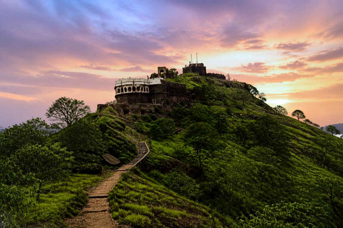
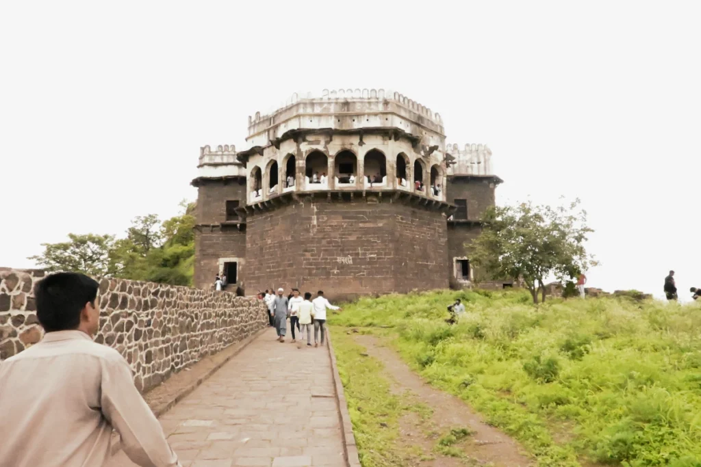
The conical rock hill, rising approximately 200 metres from the Deccan plain, was originally called Devagiri: Hill of the Gods. The Yadava dynasty, a Deccan power that ruled from the 9th to the 14th centuries, built the first fortifications here. Devagiri was their capital. The rock was their advantage. The elevation, the steep approach, and the natural defensibility of a conical hill with sheer faces on most sides made it a fortress before any wall was built.
The name changed in 1327, when Sultan Muhammad bin Tughlaq of Delhi looked at a map, decided that his capital should be in the Deccan rather than in the north, and ordered the entire population of Delhi to walk approximately 1,100 kilometres to Devagiri, which he renamed Daulatabad: City of Fortune.
The fortune did not materialise. The forced march killed thousands. Delhi emptied. Daulatabad could not support the influx. The infrastructure buckled. Within a few years, Tughlaq reversed the order and moved the capital back to Delhi. The survivors walked 1,100 kilometres a second time. Ibn Battuta, the Moroccan traveler who witnessed the court of Muhammad bin Tughlaq firsthand, documented the episode as one of the most catastrophic administrative decisions in the history of governance.
The Defence System, Layer by Layer
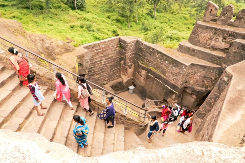
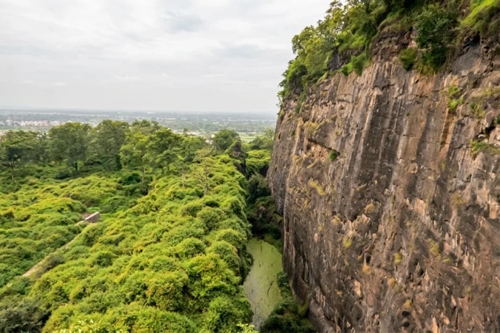
The genius of Daulatabad is not any single defence mechanism. It is the layering. Each barrier exists to catch anyone who survived the previous one. The fort does not assume any single system will work. It assumes everything will fail eventually and plans for the next failure.
The Moat
The outer perimeter is a deep, rock-cut moat that once held water and, according to local accounts and historical references, crocodiles. The moat was not decorative. A soldier who managed to reach the base of the fort walls still had to cross a body of water containing animals whose approach to border security was straightforward and non-negotiable. The moat is dry now. The crocodiles have been replaced by grass. The depth remains impressive.
The Spike Doors
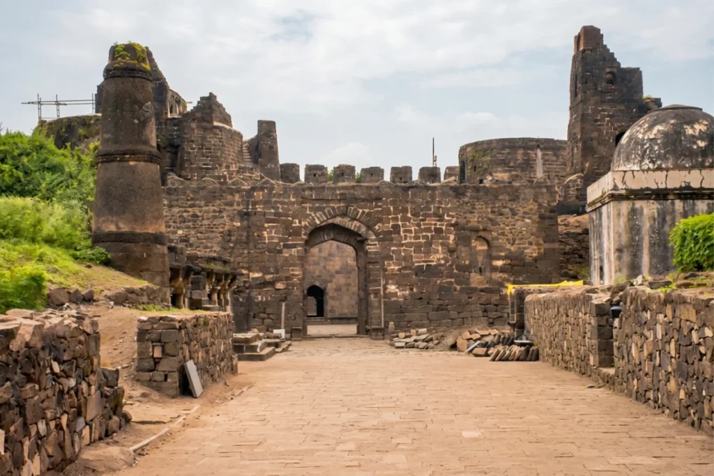
The main gates are studded with iron spikes projecting outward at elephant-head height. War elephants were the battering rams of Deccan military strategy. A charging elephant hits a gate with several tonnes of force. A gate studded with iron spikes does not stop the elephant, but it discourages the elephant from charging again, and an elephant that has been punctured once develops a reasonable reluctance to approach the same door twice. The spikes are still embedded in the wood. They are smaller than you expect from the stories and more convincing than you expect from the size.
The Bhulbhuliya
This is the feature that distinguishes Daulatabad from every other hill fort in India.
The bhulbhuliya is a rock-cut passage inside the fort’s upper levels that is intentionally dark, narrow, winding, and disorienting. The passage was designed as the final defence: if an attacking army breached the moat, survived the spike doors, and fought through the outer defences, they would enter the bhulbhuliya expecting to climb toward the citadel. Instead, they would find themselves in pitch darkness, in corridors that turn without logic, with no way to maintain formation, no way to identify direction, and no way to know whether the next turn leads upward or into a dead end.
The defenders, who knew the route, could navigate the darkness. The attackers could not. The bhulbhuliya turned the advantage of numbers into a disadvantage: more soldiers in the maze meant more confusion, more noise, more friendly-fire risk, and more targets for defenders who could operate by memory in the dark.
We walked through it. The darkness is genuine. Phone flashlights are the modern solution to a medieval defence problem. Without them, the passage is blind. The walls are close. The ceiling is low. The turns are frequent and unpredictable. The experience lasts approximately five minutes. The appreciation for the engineering lasts considerably longer. Someone designed a hallway whose primary function is to make you lost, and it works on visitors who entered voluntarily and have Google Maps on their phones. Imagine what it did to soldiers who entered involuntarily and had swords.
“The genius of the dark maze is that it turns an attacking army’s greatest asset into its fatal flaw. Superior numbers don’t matter when you can’t see your own hand in front of your face.”
The Climb
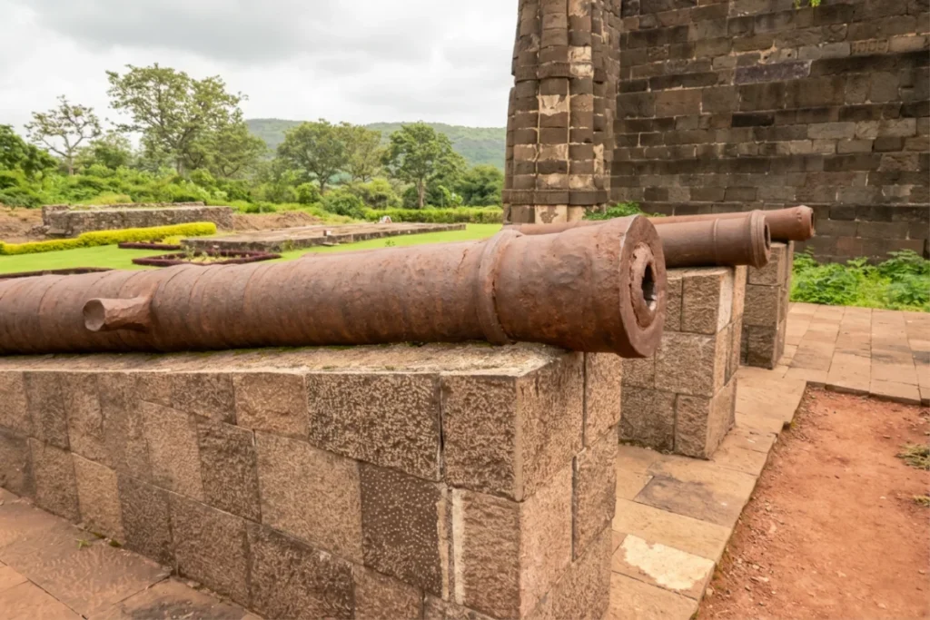
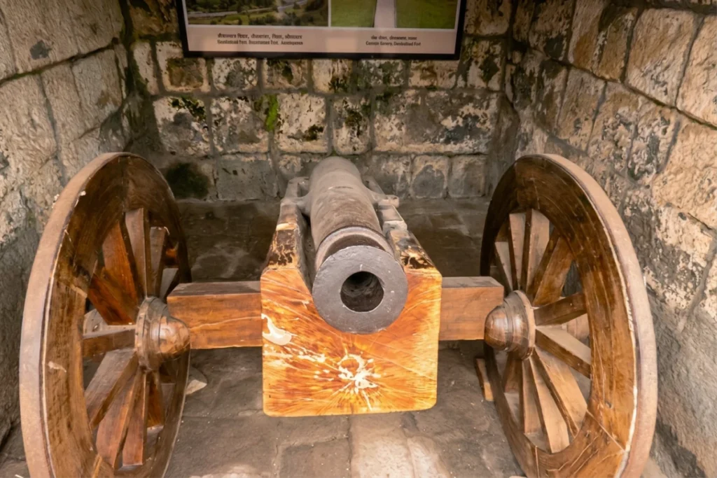
The 750 steps are not a staircase. They are a sequence of stone steps, ramps, passages, and sections of natural rock that ascend through the fort’s defensive layers from the base to the citadel. The gradient varies. Some sections are shallow and wide. Others are steep and narrow. The surface alternates between carved stone (grippy when dry, treacherous when wet) and natural rock (grippy never, treacherous always).
We climbed on an August morning. Independence Day. The heat was already building. Other visitors were climbing simultaneously, which created a human traffic pattern on the narrow sections that added negotiation to the physical effort. Families with children. Young couples. Solo hikers moving fast. Elderly visitors moving at a pace that demonstrated either admirable determination or insufficient research into what “750 steps” actually means when applied to a conical rock in the Deccan heat.
The calves register the climb at approximately step 300. The lungs register it at approximately step 500. The view begins to justify the effort at approximately step 600, when the Deccan plateau opens below you and the distance you can see expands with each additional step. By step 700, the pain and the view are in a negotiation that the view is winning.
At the top: the Deccan plateau in every direction. Flat, agricultural, vast. The fort’s position makes immediate military sense from this altitude. You can see an approaching army from 50 kilometres. You can see weather systems forming. You can see the roads that connect Daulatabad to Aurangabad, and through the haze, the suggestion of the terrain that extends toward Ajanta and Ellora.
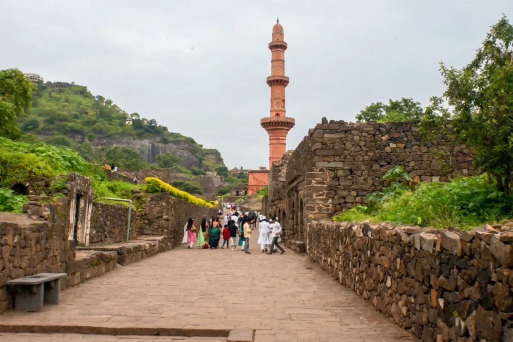
The Chand Minar, a 30-metre (100-foot) tower built in the 15th century by the Bahmani Sultanate, rises from the lower levels of the complex and is visible from the summit. Standing as one of the prominent medieval minarets of southern India, seeing it from above makes it look less like a monument and more like a pin stuck into a map.
“By step seven hundred, your legs stop asking how much farther it is to the summit, and your mind begins to wonder how anyone ever took this mountain by force.”