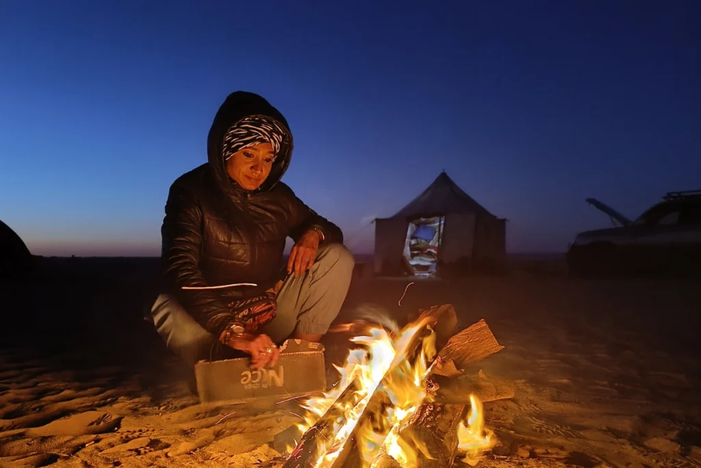
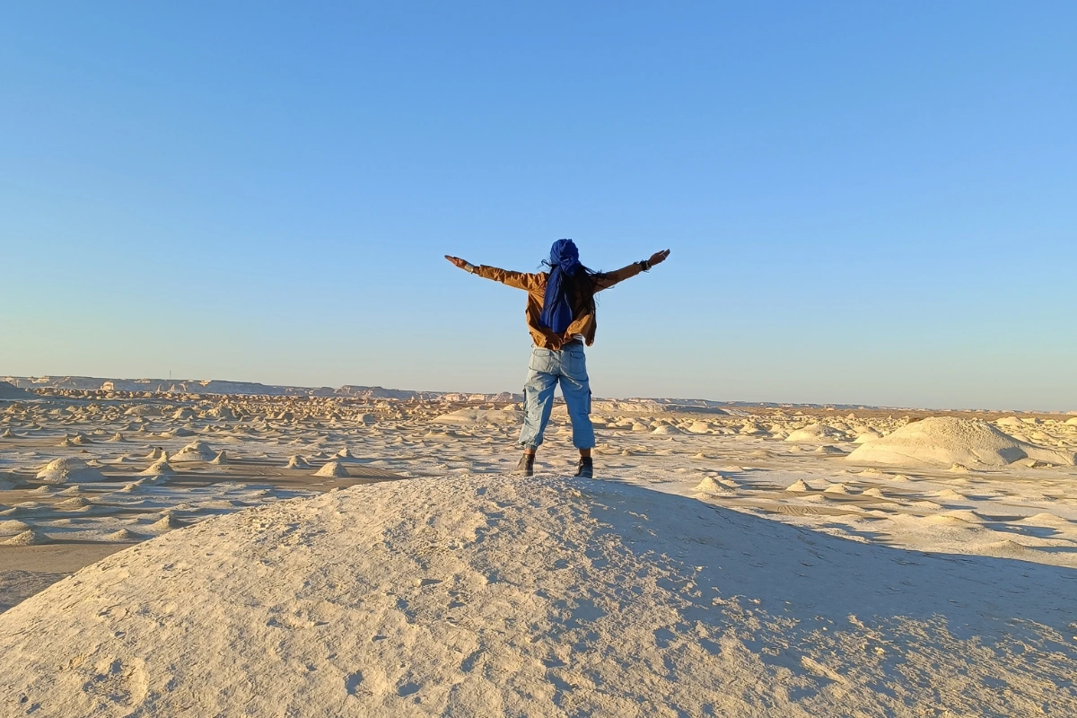
This Egypt White Desert guide explains the region’s landscape zones: what each one is, how each one formed, and how to read the landscape as a traveler rather than simply photograph it.
The first thing that needs to be said about Egypt’s White Desert is that it looks wrong.
Not wrong in the sense of unpleasant. Wrong in the sense of impossible. The chalk-white formations rising from pale sand in the middle of the Sahara look like they have been placed there. They look like sculpture. They look like the set of a film. When Sumana reached out and touched one during our visit and said “they’re not ice!”… she was expressing the response that almost every first-time visitor has: the formations are so white, so cold-looking against the desert heat, that the rational knowledge of what they are fails to override the visual impression for the first several minutes.
They are limestone. They are the compressed, eroded remnants of a sea floor. The Sahara, in the Cretaceous period approximately 70 to 80 million years ago, was covered by the Tethys Sea. When the sea receded and the land emerged, the calcium carbonate of the sea floor remained as sediment, compressed over millennia into limestone and chalk. The White Desert is what that chalk looks like after 70 million years of wind has worked on it.
But the White Desert is not the only landscape on the route. The drive from Cairo passes through four distinct zones, each formed by a different geological process across different timescales. Understanding what you are driving through before you get there changes what you see when you arrive.
“To step into the White Desert is to lose your terrestrial bearings… what looks at a distance like ice or fallen snow reveals itself under hand as ancient, sun-warmed seabed carved by relentless desert winds.”
Zone 1: The Black Desert
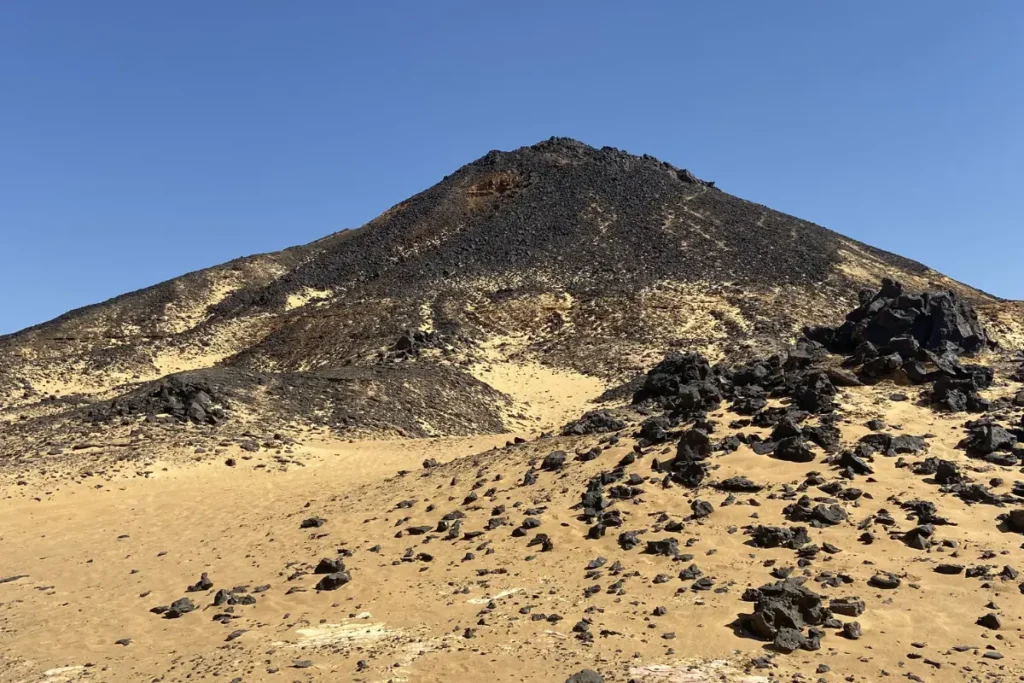
The Black Desert lies approximately 330 km southwest of Cairo, approaching the Bahariya Oasis from the north. The transition from the limestone-coloured highway landscape to the Black Desert is immediate and complete: the ground changes colour from pale beige to dark, and the flat desert suddenly fills with low, conical volcanic mountains as far as the horizon.
The Black Desert formed approximately 180 million years ago, in the Jurassic period, when a series of volcanic eruptions covered this section of the Western Desert in basalt: dark, dense igneous rock formed by solidified lava. Over the following 180 million years, the basalt mountains have been shaped by wind erosion into the flattened cone forms visible today. The black and dark brown colour comes from the iron content of the basalt, which oxidises on the surface in contact with air.
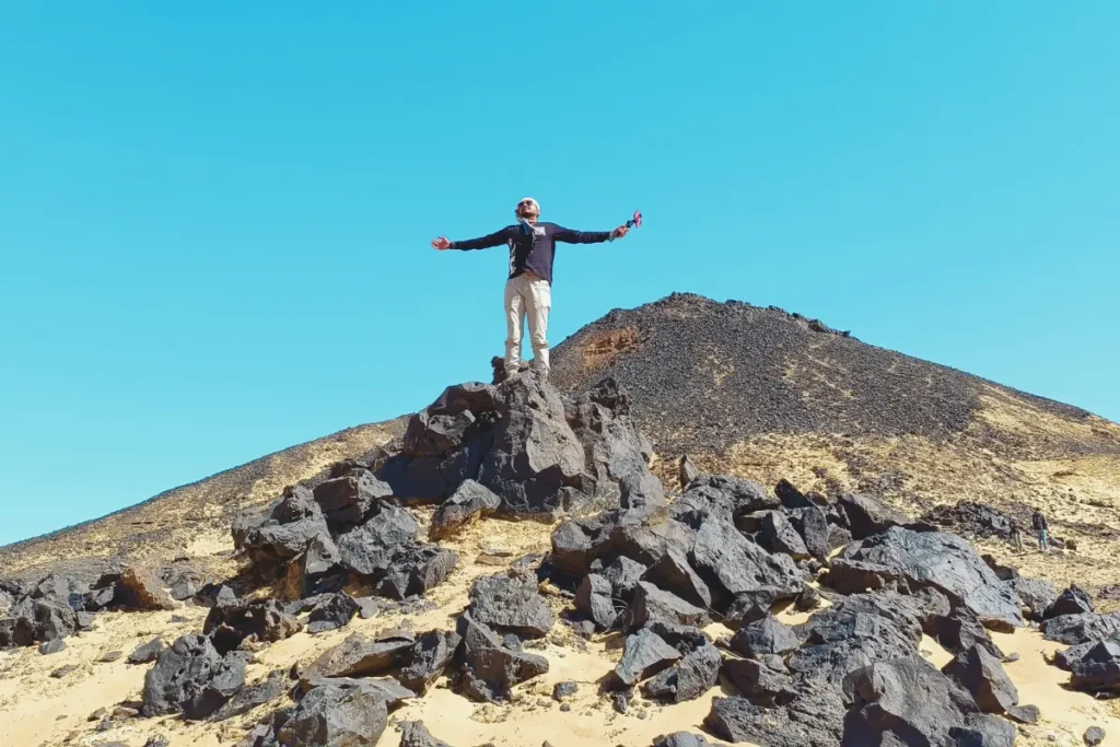
We climbed one of the volcanic mountains. The ascent through sand mixed with volcanic rock is not difficult but is slow: the loose material shifts underfoot and the footing is uncertain. From the top, the extent of the volcanic landscape becomes legible for the first time. In every direction, the same pattern repeats: conical dark shapes emerging from sandy ground, the cones formed by the resistance of the harder basalt peak against the erosion that has removed the surrounding material. The mountains look like volcanoes because they were volcanoes. The shape is not metaphor.
Akash picked up several pieces of basalt to bring home as memory. The material is distinctive: heavy for its size, dark, with a rough texture from the rapid cooling of lava. In his words from the video transcript: evidence of the destruction of the earth millions of years ago, which we will keep as proof of Jurassic time. This is an accurate description of what the Black Desert actually contains.
Standing in the middle of the Black Desert produces a specific feeling that the White Desert does not: a sense of geological violence. The landscape does not look peaceful. It looks like the aftermath of something enormous.
“Standing atop a Jurassic basalt peak in the Black Desert offers a quiet view of prehistoric violence… a sea of dark volcanic cones frozen in time across the Saharan sand.”
Zone 2: Crystal Mountain
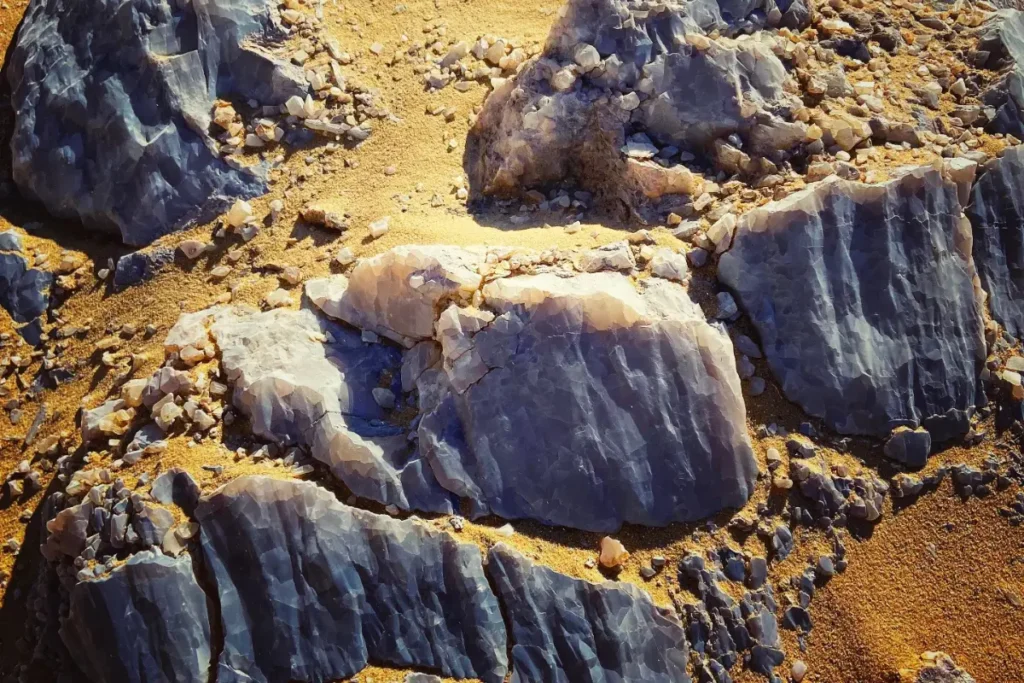
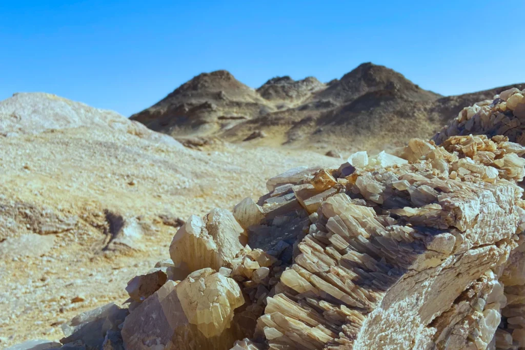
Between the Black Desert and the Agabat Valley, on the road south toward Farafra, a low ridge of pale rock appears on the road’s shoulder. This is Crystal Mountain, which is neither particularly tall nor particularly large. It does not dominate the landscape. What it does is glitter.
Crystal Mountain formed through a sub-surface hydrothermal process rather than an impact event. Millions of years ago, hot, mineral-rich fluids dissolved cavities within the limestone bedrock (a process called paleokarst formation). As these fluids cooled inside the underground chambers, they precipitated massive calcite and quartz crystals along the cave walls. Over eons, wind and weather eroded away the softer outer rock, exposing the subterranean crystal vault directly to the open air. The result is a low ridge of pale stone embedded with natural crystals that catch sunlight and reflect it.
Years of visitors removing crystals from the surface have stripped away most of the larger formations. What remains are smaller calcite crystals embedded in the rock face and the distinctive glitter of the ridge when hit by the sun. Because these formations continue to diminish through removal, what remains is worth protecting and leaving behind.
Crystal Mountain is a stopping point rather than a destination. Twenty to thirty minutes is sufficient. What it provides in that time: a direct physical experience of meteorite impact geology, the specific texture of crystal-embedded stone, and the transition between the Black Desert’s volcanic character and the chalk character of what comes next. It is a geological reset button between two completely different landscape systems.
Zone 3: Agabat Valley
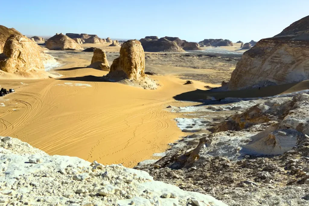
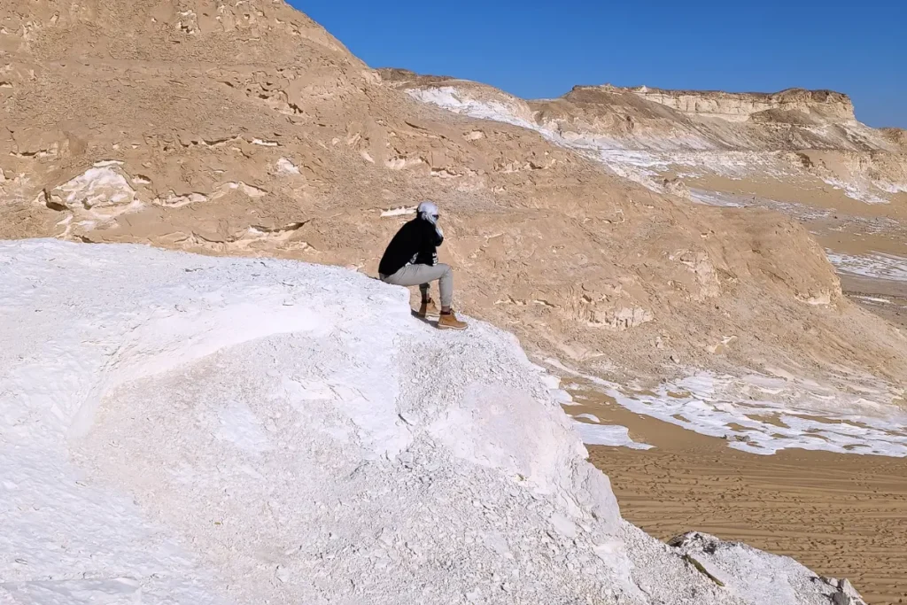
After Crystal Mountain, the landscape transitions completely. The basalt mountains and the crystal ridge disappear. White chalk formations begin to appear, initially small, then progressively larger as the road approaches the Agabat Valley.
Agabat Valley is the pre-emptive version of the White Desert: the same chalk material, the same wind-eroded forms, but gathered in a specific valley setting that concentrates the effect. The formations in Agabat are larger than much of the White Desert proper, and the valley floor between them holds a detail that is easy to miss: embedded in the white chalk surfaces, at multiple heights along the rock faces, are fossil oyster shells.
Fossil oyster shells in the middle of the Sahara Desert are the direct, physical evidence of the Tethys Sea. These shells were living organisms on the sea floor 70 to 80 million years ago. When the sea receded, the shells were incorporated into the calcium carbonate sediment that compressed into the chalk that now forms the Agabat Valley walls. They are still there. You can touch them with your finger. You are touching the shell of a creature that lived in a sea that covered this place before the Himalayas existed, before India separated from Africa, before the dinosaurs had gone.
We stood in Agabat Valley and Sumana said: “Just imagine! Millions of years ago this place was under the sea!” and then: “Oyster shells can still be seen among these white rocks! It is amazing to think of standing in a dry sea!” Both statements are geologically exact. You are standing in a dry sea. The oysters are the proof.
“To run your finger over a 70-million-year-old fossilised oyster shell in the middle of the Sahara is to realise that you aren’t just standing in a desert… you are walking along the silent floor of an ancient ocean.”
Zone 4: The White Desert
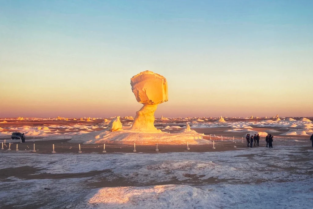
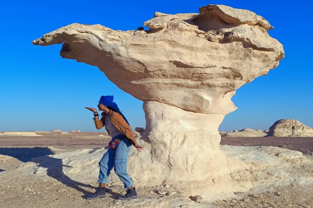
Approximately 45 km north of Farafra, the White Desert proper begins. The chalk formations that appeared individually in Agabat now multiply. The landscape stops being scattered outcrops and becomes a continuous field of shaped chalk structures extending in every direction from the road.
How the Formations Form
The White Desert’s chalk formations are created by a process called differential erosion. The Tethys Sea deposits left a chalk plateau of variable composition: some sections are denser and harder than adjacent sections, reflecting differences in the original sediment. As wind erodes the plateau, the softer material around the harder cores is removed faster. The harder core is left standing, a column of chalk that resists the wind longer than its surroundings. This is the basic mechanism.
The specific shapes that result depend on where within the chalk column the hardest material is concentrated. When the harder material is at the top, the wind removes the softer material below faster, producing a narrowing column that broadens again at the harder cap: the mushroom shape. When the hard material is distributed through the column, the erosion produces more vertical, even-sided pillars. When the hard material is at multiple heights, the wind carves multiple bulges in the same column.
The result is a landscape of varied forms: mushrooms, arches, columns, inverted cones, and shapes that have no common noun. The Bedouins who have lived with this landscape for generations have named the recognisable ones: the chicken, the camel, the mushroom, the sleeping cat. These names are not whimsical. They are the navigational vocabulary of people who have been moving through this landscape for centuries without GPS.
The Colour at Different Times of Day
The White Desert does not have a single colour. It has a range of colours that depend entirely on the time of day and the angle of the light.
At midday, under direct overhead sun, the chalk formations are approximately the colour of bone: off-white, slightly grey, with visible surface texture. The light is flat. The shadows are minimal. The landscape looks like a photograph that has been slightly underexposed.
At late afternoon, as the sun descends and the angle narrows, the formations begin to warm. The same off-white surfaces turn amber, then gold. The shadows lengthen between the formations and deepen. The landscape looks three-dimensional in a way that midday does not produce.
At sunset, the formations turn deep orange and red before fading through pink. The transition is visible in real time, moving across the surface of each formation from the lit side to the shadow side as the sun angle changes minute by minute.
At night, under a moon, the chalk returns to white… not the warm white of afternoon but a cold, luminous white that reflects moonlight in a way that makes the formations visible in the dark without artificial light. This is the version of the White Desert that the overnight stay is designed to provide.
At dawn, the warm colours return in reverse order: pink first, then amber, then gold, before the direct light arrives and the formations return to their midday character.
What the Formations Are Named
The Bedouin names for the recognisable formations work as orientation points and as shortcuts to specific forms. The chicken: a compact, rounded formation with a narrow neck below a wider body, identifiable from any approach angle. The mushroom: the classic widened-cap form, the most common of the named shapes and the one most frequently reproduced in photographs. The camel: a formation with two rounded humps at different heights connected by a lower ridge. The sleeping cat: a low, curved form with a rounded head shape at one end.
None of these names are official designations. They are the accumulated vocabulary of generations of Bedouin guides, passed to visitors as navigational and interpretive tools. Using them does two things: it names the landscape in a way that makes specific formations identifiable and discussable, and it acknowledges the human knowledge that has been layered over this geological landscape across centuries of habitation.
Sandboarding: Reading the Dunes
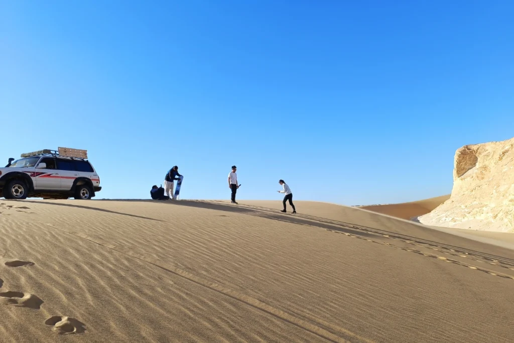
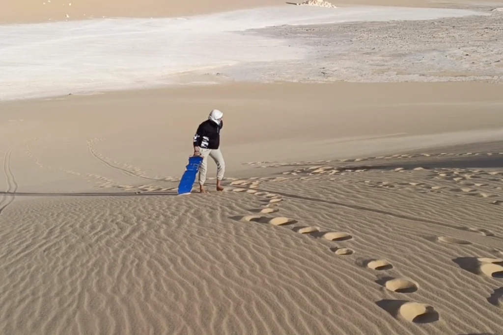
In the area approaching and around the Agabat Valley, the wind that shapes the chalk formations also shapes the sand that surrounds them into dunes. These dunes are usable for sandboarding, which is exactly what it sounds like.
Sumana went first. She fell. Akash went next and stayed upright, a fact that continues to be noted differently by each party. The sandboarding itself is brief… the descent of a single dune takes only seconds… but the experience of standing at the top of a sand dune in the middle of the Sahara with a board underfoot, with the chalk formations of Agabat Valley visible in the background, is unforgettable.
The dunes are not large in the Alpine or Saharan-dune sense. They are desert dunes: steep enough to produce a fast descent, wide enough to allow a run, and soft enough that a fall (Sumana’s) is not painful. The sand is very cold in February. The descent is fast. The context is the rest of it.
How the Four Zones Relate
| Zone | Formed By | Age | What You See |
| Black Desert | Volcanic eruptions | ~180 million years (Jurassic) | Dark basalt cones, volcanic rocks, lava pieces |
| Crystal Mountain | Hydrothermal cave collapse / crystallization | Geological (specific date unknown) | Pale ridge with quartz and calcite crystals glittering in sunlight |
| Agabat Valley | Tethys Sea deposits + wind erosion | 70–80 million years (Cretaceous sea) | White chalk formations with embedded fossil oyster shells |
| White Desert | Wind erosion of chalk plateau | 70–80 million years (ongoing erosion) | Chalk columns in named and unnamed forms: mushrooms, chickens, arches |
The route from Cairo to the White Desert is a journey backward through geological time. The Black Desert is 180 million years old. The White Desert is 70 to 80 million years old. The drive south covers 100 million years of geological history across approximately four hours of highway.
When to Go and What to Bring
- October to March is the viable window. Summer temperatures in the Western Desert exceed 40°C and camping or outdoor exploration is genuinely dangerous. We visited in February and the nights were cold enough to require the sleeping bags provided by our guide Mahmood.
- The overnight stay is not optional for the full landscape experience. The White Desert’s colour range across a full day and the night sky under a moon or stars are the experiences the area is designed to provide. A day trip from Cairo covers the geography but misses the most significant qualities of the place.
- A guide is essential. Mahmood drove us through the entire route, explained the Bedouin names for the formations, selected the camp location, and managed every practical element. The desert is a national park with unmarked trails and significant distances between zones. Independent navigation without a guide is inadvisable.
- Carry warm clothing regardless of the month. Desert temperature swings between day and night are extreme. February nights in the White Desert are significantly colder than Cairo daytime temperatures. The same coat that was excess on the way to Bahariya Oasis was necessary by the time we reached camp.
- The crystals at Crystal Mountain: look, hold one briefly, put it back. The population of accessible crystals on the surface is diminishing because visitors have been removing them for decades. What remains is worth leaving for the next visitor.
- The fossil oyster shells in Agabat Valley: look for them embedded in the chalk face of the formations. They are at varying heights. They require close inspection. They are easy to miss if you are looking at the landscape from a distance rather than examining the rock surface up close.
- The sandboarding equipment is provided by the guide in standard packages. It does not require previous experience. It does require willingness to fall, which is more likely than not on the first run.
“The Western Desert is not merely a place you travel across… it is a landscape you read. Four hours on the road takes you back a hundred million years, from Jurassic volcanic fields to an ancient ocean floor where the quiet earth still carries the shape of water.”